My spot failed me a little today. We didn't really go from point 47 to point 48 on this map in 10 minutes. Actual time was about 2 hours. I think the tree canopy may have stopped Spot from talking to the satellite. Also, we started at point 30 today. Here's a better map of today's travels…
Rt. 49 out of Mariposa is outstanding. The road is new blacktop, newly lined, with a very consistent surface. I don't think we experienced a single bump the entire time. The curves are fantastic; though, many of them are blind and require lots of attention to your speed and line.
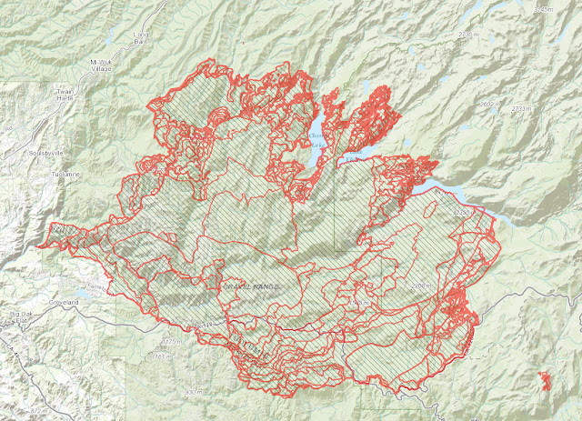
Our first stop in the park was at some fire damaged areas. It's unsettling and pictures can't describe how bad it is. Here's a map of the fire damaged areas…
I don't have any sponsors; but my friend Paul works for ESRI, a Geographic Information Services (GIS) company. He made this map using their arcgis web tool. www.arcgis.com This is the same tool that the firefighters were using and populating data into. During this fire, firefighters were flying over this fire collecting data, infrared and otherwise, and populating this tool. Behind this map and each little perimeter is a series of data. You can click through this map on arcgis server and see all that data. It's an incredibly powerful tool. Thanks Paul for taking the time to show me all this.
If you happened to be asleep in July, when the fire started, here's what you missed…
And finally, some of today's pictures…


Beautiful pics but it's so sad seeing the burned out areas. Poor trees!!!!
ReplyDelete