My lazy butt stayed in bed until 7:23am. One would think that the excitement of doing the Tail of the Dragon again and scratching Kentucky off my list of states I haven't visited on a motorcycle would have had me out of bed; but, it didn't. As per normal procedure, I checked weather and confirmed my routing. The plan was to go around Atlanta and to check out some of GA's back country, so I routed through Athens and then up to Robbinsville - the town closest to the beginning of the Southern entrance to the Dragon.
Road kill has a much more pungent smell to it in Georgia. I don't know what they season it with; but, it is different from road kill everywhere else in the country. The other thing of note is the very distinct smell of trash in Georgia. It felt like I was following a garbage truck for miles. Maybe I was.
For the one or two people that are reading my blog, I have to mention that 129N and 411N south of Tail of the Dragon are not to be ignored. These are great warmups for the Tail. As luck would have it, it was drizzling leading up to the Tail and the Tail was wet when I got to it. That didn't seem to slow me down at all. For those detail oriented riders, I'm running Michelin Road Pilots (3 up front and a 4 in the rear).
The Tail is like Thanksgiving Dinner - lots of time thinking about it, maybe even planning for it; and then, it's all over in like 15 minutes or so.
After the Tail, I continued on and decided a good place to stop was Corbin KY. I could keep going; but, this stopping point gave me some good options and I didn't have a plan after I got to KY anyway. So, hotel it, charge everything, gas the bike and look at a map. That's the plan.
Saturday, August 8, 2015

20150806 - Spring Hill Fl - Cordele GA (then on to Washington D.C.)
First, my apologies for not having blogged in a long time. Whoever you are that reads my blog, I appreciate it and I'm sorry if I let you down. Statistics show that you, a single individual (or maybe two) consistently read my blog entries as I post them. Someday, I hope to have a readership of 3 and I know I won't get there if I continue to treat my readership this way. I humbly apologize.
I rarely have an uneventful trip and this first part of my journey is no exception. Since I never plan and always procrastinate when possible, I found myself at the end of the work day wanting to leave, without anything packed. The usual follies ensued - where's my umptyfratz charger, for that matter, where's my umptyfrats. The funny thing is that I could care less about clothes as long as I have the right electronic gear, chargers and credit cards. My closets are evidence of me having had to buy articles of clothing on many trips. I digress. Fortunately, I've done the motorcycle travel thing many times, so I know just what to pack and how to pack it. This trip was going to be particularly exciting because there is no need to take heated gear with me. I tend to pack light on the motorcycle and I like to make sure the bag I strap to the seat is full, as it serves as a back rest. On this trip, there is almost nothing in the hard side cases - not the best for center of gravity; but, with this bike, the CG is plenty high to begin with. I'm packed. I leave. It's 5:30 and I'm impressed because I stopped work at 5 sharp and managed to also clean the kitchen.
Starting this journey wasn't as fun as many. There are so many things to worry about now. I'm a supposedly responsible fish owner, I have a house now and I have grass that grows. There's also a pool that needs chlorine and on and on. It didn't take long and I was into my ride. It's funny how I navigate very long trips without ever picking up a map or using the GPS. The route was to be I 75 all the way to Atlanta. I really had my hopes set on making Atlanta, even though it would be midnight. Friday morning traffic is horrendous and I'd like to avoid that.
Atlanta was a destination too far. Mother nature is always in control and she thought it would be best for me to stop on Cordele GA; but, not before explaining to me in a gentle way (heavy rain with lightning) that going on was going be comfortable. I tried to get into this little inn where I pulled off; but, the entrance was dug up and they were clearly under construction. I needed to turn around and drive another 7 miles to a hotel. The interesting feature about this hotel was the air conditioner. Almost everywhere in the world, there are numbers between 57 and 71; in fact, there are an infinite number of numbers between 57 and 71. This is not the case in Cordele GA. In Cordele, there are no numbers between 57 and 71. The air HVAC in my room went straight from 57 to 71. Clearly, whoever did this was brought up on Common Core and using safe numbers or something.
Of interest on this trip was getting hit in the helmet by a fruit bat at 75 mph. In the Universe of things, a tasty mosquito and 1,000 pounds of motorcycle and rider are not much different until you zoom in a bit. So it's quite understandable that a bat can fly into my helmet. If his radar wasn't jacked up before he hit me, it certainly is now...or maybe it's be knocked into alignment now. At this point, the carnage I've left behind in my years of motorcycle riding is 2 birds, a groundhog and a bat.
I rarely have an uneventful trip and this first part of my journey is no exception. Since I never plan and always procrastinate when possible, I found myself at the end of the work day wanting to leave, without anything packed. The usual follies ensued - where's my umptyfratz charger, for that matter, where's my umptyfrats. The funny thing is that I could care less about clothes as long as I have the right electronic gear, chargers and credit cards. My closets are evidence of me having had to buy articles of clothing on many trips. I digress. Fortunately, I've done the motorcycle travel thing many times, so I know just what to pack and how to pack it. This trip was going to be particularly exciting because there is no need to take heated gear with me. I tend to pack light on the motorcycle and I like to make sure the bag I strap to the seat is full, as it serves as a back rest. On this trip, there is almost nothing in the hard side cases - not the best for center of gravity; but, with this bike, the CG is plenty high to begin with. I'm packed. I leave. It's 5:30 and I'm impressed because I stopped work at 5 sharp and managed to also clean the kitchen.
Starting this journey wasn't as fun as many. There are so many things to worry about now. I'm a supposedly responsible fish owner, I have a house now and I have grass that grows. There's also a pool that needs chlorine and on and on. It didn't take long and I was into my ride. It's funny how I navigate very long trips without ever picking up a map or using the GPS. The route was to be I 75 all the way to Atlanta. I really had my hopes set on making Atlanta, even though it would be midnight. Friday morning traffic is horrendous and I'd like to avoid that.
Atlanta was a destination too far. Mother nature is always in control and she thought it would be best for me to stop on Cordele GA; but, not before explaining to me in a gentle way (heavy rain with lightning) that going on was going be comfortable. I tried to get into this little inn where I pulled off; but, the entrance was dug up and they were clearly under construction. I needed to turn around and drive another 7 miles to a hotel. The interesting feature about this hotel was the air conditioner. Almost everywhere in the world, there are numbers between 57 and 71; in fact, there are an infinite number of numbers between 57 and 71. This is not the case in Cordele GA. In Cordele, there are no numbers between 57 and 71. The air HVAC in my room went straight from 57 to 71. Clearly, whoever did this was brought up on Common Core and using safe numbers or something.
Of interest on this trip was getting hit in the helmet by a fruit bat at 75 mph. In the Universe of things, a tasty mosquito and 1,000 pounds of motorcycle and rider are not much different until you zoom in a bit. So it's quite understandable that a bat can fly into my helmet. If his radar wasn't jacked up before he hit me, it certainly is now...or maybe it's be knocked into alignment now. At this point, the carnage I've left behind in my years of motorcycle riding is 2 birds, a groundhog and a bat.
Sunday, May 3, 2015
20150501 - Florida Panhandle
Excuses first. While I've been in Florida, I've been searching for a house. It's occupied a lot of my time. Riding, unfortunately has suffered and I haven't done nearly as many long distance trips. That said, I have done a bunch of little ones. For me to blog about a trip, it needs to either be greater than 250 miles, or have some special significance. The good news is that I'm supposed to close on a house on the 15th of this month and once I'm settled in, I should be back on the road. It also looks like my contract might end in June, so I might be able to do the Alaska trip in July. That would clearly make up for all riding sins.
So, on Thursday, I get a text message from Susie. I haven't seen her since I'd say 2004, maybe 2003. She is coming to Florida, Panama City Beach to be exact and then headed out to Louisiana I think. I have other friends Tom and Charity who live in the area and thought it would be fun for all of us to get together. As if I need an excuse to get on the bike and ride, and with my home just waiting on the seller to close, off I went.
This is a no GPS needed kind of trip; down Little road, North on 19, West on 98 to Panama City. The hardest part was going to be finding Susie. Tom had a date and couldn't make dinner. Charity is nowhere to be found. Tom will meet us for breakfast.
The ride is fantastic. Once you're out of the urban sprawl, things open up nicely and once you start going west, things get good quickly. The turn west starts with open road and plenty of greenery. The trees are plenty tall, so you can't see all that far; but, one thing is for sure, all that green is awesome, compared to the browns of the West. Until I lived out West for awhile, I never realized how much I like green. I digress. Before too long, I started crossing a bunch of bridges and large expanses of water. I really like this kind of riding, where there is water on all sides. In fact, so far, this is the only ride, other than through the Keys where I've been able to ride over open water, or within sight of open water for such a long period of time. The only other place where I think a ride like this is possible, east of the Mississippi might be in NE Florida, Rt. A1A, or the rest of the panhandle. I haven't ridden those parts yet and am pretty sure the East coast doesn't feature rides like this. Here's a 20 second sample. I cut the audio out. It's all loud wind noise!
So, I arrive in Panama City Beach and quickly learn that "Thunder Beach" is going on. There are tens of thousands of bikes here, most of them Harley's or custom built choppers; all loud. I also saw, for the first time a Suzuki R1300. It's long and has a very low height. It looks like it would take a football field to turn around in.
So, I manage to find a room, which I think was probably a minor miracle given all these bikers. Parking is between two buildings and is for motorcycles only. I was clearly out numbered by the Harley crowd. Fortunately, I think everyone was tucked in fairly early last night. I heard a few bikes come and go; but, by 5am, engines were starting and I was quickly awake.
Before retiring for the evening, I had dinner with Susie and her brother Billy at Saltwater Grill. Of course, I Yelped for it. It was rated well. The food wasn't ok. Nothing special. For breakfast, the three of us joined our friend Tom. Tom, Susie and I all worked for a the US Treasury as contractors once upon a time. It was great getting together with folks I hadn't seen in over 10 years!
As of this moment, the map of places I've ridden on the K1600GT looks like this. I think I need to close the gap between Panama City Beach and Mobile, just on the account of because. That, however will happen once I'm going to go out west. From my house, all points West include 10 across the panhandle. There's no need to go it now.

So, on Thursday, I get a text message from Susie. I haven't seen her since I'd say 2004, maybe 2003. She is coming to Florida, Panama City Beach to be exact and then headed out to Louisiana I think. I have other friends Tom and Charity who live in the area and thought it would be fun for all of us to get together. As if I need an excuse to get on the bike and ride, and with my home just waiting on the seller to close, off I went.
This is a no GPS needed kind of trip; down Little road, North on 19, West on 98 to Panama City. The hardest part was going to be finding Susie. Tom had a date and couldn't make dinner. Charity is nowhere to be found. Tom will meet us for breakfast.
The ride is fantastic. Once you're out of the urban sprawl, things open up nicely and once you start going west, things get good quickly. The turn west starts with open road and plenty of greenery. The trees are plenty tall, so you can't see all that far; but, one thing is for sure, all that green is awesome, compared to the browns of the West. Until I lived out West for awhile, I never realized how much I like green. I digress. Before too long, I started crossing a bunch of bridges and large expanses of water. I really like this kind of riding, where there is water on all sides. In fact, so far, this is the only ride, other than through the Keys where I've been able to ride over open water, or within sight of open water for such a long period of time. The only other place where I think a ride like this is possible, east of the Mississippi might be in NE Florida, Rt. A1A, or the rest of the panhandle. I haven't ridden those parts yet and am pretty sure the East coast doesn't feature rides like this. Here's a 20 second sample. I cut the audio out. It's all loud wind noise!
So, I manage to find a room, which I think was probably a minor miracle given all these bikers. Parking is between two buildings and is for motorcycles only. I was clearly out numbered by the Harley crowd. Fortunately, I think everyone was tucked in fairly early last night. I heard a few bikes come and go; but, by 5am, engines were starting and I was quickly awake.
Before retiring for the evening, I had dinner with Susie and her brother Billy at Saltwater Grill. Of course, I Yelped for it. It was rated well. The food wasn't ok. Nothing special. For breakfast, the three of us joined our friend Tom. Tom, Susie and I all worked for a the US Treasury as contractors once upon a time. It was great getting together with folks I hadn't seen in over 10 years!
As of this moment, the map of places I've ridden on the K1600GT looks like this. I think I need to close the gap between Panama City Beach and Mobile, just on the account of because. That, however will happen once I'm going to go out west. From my house, all points West include 10 across the panhandle. There's no need to go it now.
Saturday, March 14, 2015
Garmin Basecamp Review
My Configuration
I'm running OS X Yosemite on an 11" MacBook Air and BaseCamp 4.4.5, which is the latest at the time of this writing. My GPS is a Garmin Nav IV that came with my K1600GT.What I Tested
Basecamp seems like it has a lot of capabilities and over time I'll test more of them; but, this test was to create and ride a 100 mile loop near my house. For this test, I needed to load BaseCamp on my computer, update my maps and software, plot the route, download the route and ride it with all the expected voice and visual queues I'd expect if riding a route created right on the GPS. Along the way, I downloaded and reviewed previous routes I've been on. This worked exceptionally well and was easy.What I Didn't Test
BaseCamp is pretty feature rich. You can create a long distance trip over multiple days, add way points, search for lodging and eateries in the area where you will stop each night, etc. I only looked at this briefly and found that it wasn't intuitive, so I bailed on it for now, for a simpler test. I will probably write more about the trip functionality once I understand it better.Installation
Installation was a breeze. Download, next, next, accept, next, next, OK, next, bingo...or something resembling that.Once the clickfest ended, I opened BaseCamp and immediately got a notification that my GPS wasn't connected. Well, it was in fact, still in the cradle on my bike. It took me about half an hour to figure out how to get it out of my K1600GT. It's never been out before. If you're riding a K16 and have no clue, raise the windshield, press the button to the left of the screen, reach under the unit and make sure it is as high up as possible, find the lever behind the top right of the unit to release it from the cradle, tilt it forward and pull it out.
So, now I'm in BaseCamp, with my GPS attached and want to update my software and maps. You can't do that in BaseCamp. For that, you need to download and install Garmin Express using the same clicking procedure as is standard with darn near every piece of software you get these days (outlined above). Once in, I tried to do the update; and was able to update the software; but, the maps wouldn't update all the way. I called Garmin and they made me switch to the latest version of Express and then everything worked fine. They led me through it and were really professional and helpful. They get a gold star for support in my book.
Back to BaseCamp with a completely updated GPS. Being a computer geek, I'm not one to read a manual or watch an instructional video. I believe software needs to be intuitive, or they need to do a better job in the next release. I would say BaseCamp is not intuitive. I had to go watch videos on YouTube (Boo, :-( , etc.). Finally, I started to understand how their interface works enough that I was able to create some routes.
Needs improvement
The Interface is Clunky. It's not that you need a degree in Computer Science to operate it (I have one), it's that it's not intuitive. As an example, when you use Google Maps and want to change your route, you just drag one section to the place you want to go. It's simple. You can also just type your way points right into the interface. So, if you want to go from Miami Florida to Seattle Washington by way of Atlanta Georgia, Memphis Tenn, Denver Colorado, Yosemite National Park and Boise Idaho, you just type that in and wham, you have a route that you can simply adjust. I haven't figured out any way to just do that yet - not intuitive.Another problem with the interface is that you're constantly selecting tools, kind of like when you're using photo editing software. You have choices between zoom tool, pan tool, pointer, etc. You either use the right tool, or you get to do it again. I think better use of the mouse/track pad is in order here.
Particularly distressing is the ability to zoom on the fly. Say you're going on a trip from the acquarium in Tampa Florida to your favorite bistro in Atlanta Georgia. You zoom all the way in on Tampa, find the acquarium, switch to the route tool, click on the acquarium. Now, you're zoomed in so tight, there's no way you will see Atlanta, or for that matter anything further than a couple blocks from the aquarium, so you figure out that you have to use the + and - keys to control zoom, get the picture big enough that you can now see Atalanta, but, now what? You can see Atalanta and Tampa in the same screen; but, forget about using your zoom tool to zoom in on Atlanta because you will zoom right back in on Tampa. Remember, you're still in your routing tool, so clicking on the map will reorient your zoom; but, also plot a route to that point. What I had to do was exactly that - drop a point on the route over Atlanta and then start to zoom in on my point. Say the point is on the Northwest of city center and when you zoom in, you realize that you dropped your point Southwest. I just hit control Z, and then clicked on a point closer to my destination and repeated until I had it right where I wanted it. I'd say that's pretty clunky and I hope that after I watch a couple more hours of video, I'll find there's a better way. As a sidebar, the videos were produced by some marketing guy, I'm sure of it. I don't need to be sold. I already have the product. Explain it to me, don't sell it to me. I digress.
The third nasty surprise is moving a point on a route. Back to our example with Google Maps... Got a route and want to bend it to another highway? No problem, grab it and drag it. Done. Not so much with this interface. I think you hold the option key and then click. When you do, you get these crazy vector cross hair kind of things that make you think you're about to vector a missile into outer space or something. It clearly makes you think you believe you learned something about this in sophomore year geometry; but, you forgot it. Either way, you have to drag a point before the intersection of the part of the route you want to move or it won't work the way you expect. Wait! I think it's the other way around. You may have to grab a point of the leg after the intersection... See what I mean? It's a disaster. I haven't moved very many points this way at all. It should be intuitive and it's not. I'll watch more instructional videos.
Worked Well
Clearly, I can (with a little work) make my own routes and upload them. I can also download previous routes. Having this much control over my routing is outstanding. Up until now, the only controls I really had were shortest vs. fastest route plus avoidances (traffic, highway, toll, ferry, etc.). This is a major step up. I can also share my routes with other people. So, if I happen to find the most awesome-est route through Yosemite National Park, I can download it, send it to a friend, who can upload it into their GPS and ride it. This is a really awesome capability.I tried hard to make BaseCamp take a route that violated my preferences. It wouldn't do it. I said no highways and Garmin carved that into stone. When part of my route would have been faster and shorter by using the highway, Garmin stuck to it's...software code (since it doesn't have guns) and routed me according to my preferences. No matter what I did to try to trick it into taking the highway, it wouldn't.
I liked that Garmin requires you to plug in your GPS. I know they do it for licensing reasons; but, by making you do that, you're guaranteed not to get a route out of BaseCamp that you can't ride because your map isn't up to date. I see this as a plus. I also see it as a plus because as as long as you're plugged into a laptop with an Internet connection, you can update your map.
Riding the route, my GPS prompted me just as I expected. In fact, I was a little careless in clicking my route points and in one case, I actually clicked on the airport, about a quarter mile from the intersection, so the GPS tried to take me there. The good news is that when I ignored the point and stayed on the rest of the route, it didn't try to recalculate my route back to the point I missed.
The Final Word
Quality software needs to do 4 things in my mind: 1) It needs to install without any issues. 2) It needs to function as intended. 3) The user interface/experience must be exceptional. 4) It must be secure. Now, security isn't really a factor for this review, so I give it 100% for Install, 100% for Function (in fact, there is very cool functionality I haven't tested yet) and I give it 50% for user interface / experience, for 250 of 300 possible points, or a grade of 82.5% or B-. In my opinion, Garmin can add a thousand other functional components; but, until they make the user interface / experience better, they will never earn an A.Sunday, March 8, 2015
20150307 - Riding a big street bike in a freshly plowed farmer's field
There's only two real reasons for you to be reading this. Either you want to try this, or you're shocked that someone would take a 750#+ motorcycle off road. If you fall into the second category, please read on and be entertained. If you fall into the first category, I recommend that stop now, search for mental health professionals in your area, particularly one that also rides, and heed their advice.
Now, if you're still reading and convinced that you're going to do this, there are some things that I recommend you bring along and do to prepare for your adventure.
So, the GS Giants were putting on a rally this weekend and I was invited along. We were going to hit Destination Daytona first and then head out and meet some serious off road riders. The thought was that I'd hang with these guys as long as I could, grab some pavement and meet them at the next land mark with an address and a nice cold sweet tea. That isn't exactly how it turned out. They have this idea of a roll chart and it doesn't have addresses on it. Landmarks are hard to come by.
There was a difference of opinion as to how hard the "easy" route was and someone even speculated that it could be done 2 up. Another router planner couldn't believe I would try it on a K16 and thought I was BSing him. After about 5 minutes of "no seriously, I'm riding a K1600GT," he told me I wouldn't make it.
The next morning, we all met. There must have been 60 or more bikes. We went over the rules and were off. It worked out that there were some folks that really were a bit apprehensive and wanted to stay with our group. We were happy to have them along. There were about 7 of us in our little group.
As I said before, I have no experience in the dirt; but, reasoned that the challenge was to go fast enough to keep forward motion; but, not so fast that my Road Pilots would lose traction. I also reasoned that I should probably look far ahead and not worry about the ruts and tracks; be loose in the elbows and let the bike find it's way. That proved to be a good strategy. Finding that sweet spot wasn't hard. When the rear end breaks loose, you know you need to gently get off the throttle and not grab the brake; lest one wants to high side the bike. The trick is to keep your balance while the bike is finding it's way. The whole side ways slipping motion isn't all that foreign. It sort of feels like riding on a rear tire that is going flat.
At some point, I got the bike sideways; but, I never stopped and managed to pull out of it. The rear end came around to the right, I turned the handlebars all the way to the right, just like taking a rear wheel drive car out of a skid, and got off the throttle. I was focused more on balance. At some point I got a bit anxious and put my left leg down at which point, the bike swung back around and my leg almost went under the hard case on the left. I quickly learned that I need to resist that urge and keep my feet on the pegs at all times. I got a bit more than a half mile of this before I retired to hard pavement. I had learned a lot and continuing would simply be pressing the good luck I was having so far. Half a mile of this is quite a bit!
I dealt with 2 types of off road - one was the aforementioned farmers field and the other was a hard dirt surface. Actually, the hard dirt surface presents challenges of it's own. After going through 2.5 - 3" of powder like soil, you would think that hard dirt would be easy. It's not. The first thing you realize is that you're likely to bleed a lot more if you go down on this stuff. It looks very hard and foreboding; whereas a farmers field with all that soft soil seems more like it would be landing on a stack of firm pillows. I was also traveling faster, which means less reaction time. Mostly, I was doing about 25 mph on the hard surface and very relaxed. What I didn't like about it was when I hit some rut, tire track or whatever else and I'd get a shot of adrenaline. When that happens, grip tightens and so do the arms and legs - exactly what you don't need. I don't know yet how to train that out; except maybe to ride in the dirt a lot more.
At lunch, I learned that you shouldn't use the front brake off road. This might have been useful information to have before I started riding.
I have to say that I feel much more confident on this bike on dirt roads than ever before. Clearly, the bike wasn't made for this type of riding. I didn't get stuck or fall at all. I'm pretty confident that I know the traction limitations of this bike pretty clearly now and have even learned some techniques for dealing with bad terrain. That said, I don't recommend that anyone do this. I think you can get the same, and better, experience taking an off road course on a suitable motorcycle. The end result of all this is that I had a great time and will probably be starting a second blog in the next year - bobs-R1200GS.blogspot.com. Maybe I better try to register that now!
Sorry, no pics or vids yet. I was way too busy to turn on my own GoPro. If I find someone in the group that has good video, I'll post it here.
Now, if you're still reading and convinced that you're going to do this, there are some things that I recommend you bring along and do to prepare for your adventure.
- Permission from the land owner. Should you need his tractor to retrieve your bike, it would go over much better if he knew you were there in the first place. It's also beneficial that he's not running a corn combine or other mechanized machinery that will chop you to bits.
- Lots of friends. You will want friends riding in front. They will help you navigate the tough parts. If they can't make it through, you have no chance. Find another way. You will need friends behind. This is primarily so you don't get stranded as all the other, experienced, mentally balanced, riders leave you in their dust. Most everyone will want to ride behind you as it will give them the best vantage point for their GoPro videos.
- A winch. A 750# bike stuck a mile from the nearest pavement will quickly drain everyone's energy and patience. Have a plan for this.
- ATGATT. It's really likely that you're going to face plant, so you might as well put every thing on.
- First aid kit and splints. If you have to ask, please go back and chat with your mental health professional again.
- Crash bars. I'm not talking about the wimpy little single BMW engine guard, I'm talking front and back Wunderlicht crash bars.
- A sense of humor.
- No fear of falling, being laughed at and potentially hearing about it at every gathering for the rest of your life.
So, the GS Giants were putting on a rally this weekend and I was invited along. We were going to hit Destination Daytona first and then head out and meet some serious off road riders. The thought was that I'd hang with these guys as long as I could, grab some pavement and meet them at the next land mark with an address and a nice cold sweet tea. That isn't exactly how it turned out. They have this idea of a roll chart and it doesn't have addresses on it. Landmarks are hard to come by.
There was a difference of opinion as to how hard the "easy" route was and someone even speculated that it could be done 2 up. Another router planner couldn't believe I would try it on a K16 and thought I was BSing him. After about 5 minutes of "no seriously, I'm riding a K1600GT," he told me I wouldn't make it.
The next morning, we all met. There must have been 60 or more bikes. We went over the rules and were off. It worked out that there were some folks that really were a bit apprehensive and wanted to stay with our group. We were happy to have them along. There were about 7 of us in our little group.
As I said before, I have no experience in the dirt; but, reasoned that the challenge was to go fast enough to keep forward motion; but, not so fast that my Road Pilots would lose traction. I also reasoned that I should probably look far ahead and not worry about the ruts and tracks; be loose in the elbows and let the bike find it's way. That proved to be a good strategy. Finding that sweet spot wasn't hard. When the rear end breaks loose, you know you need to gently get off the throttle and not grab the brake; lest one wants to high side the bike. The trick is to keep your balance while the bike is finding it's way. The whole side ways slipping motion isn't all that foreign. It sort of feels like riding on a rear tire that is going flat.
At some point, I got the bike sideways; but, I never stopped and managed to pull out of it. The rear end came around to the right, I turned the handlebars all the way to the right, just like taking a rear wheel drive car out of a skid, and got off the throttle. I was focused more on balance. At some point I got a bit anxious and put my left leg down at which point, the bike swung back around and my leg almost went under the hard case on the left. I quickly learned that I need to resist that urge and keep my feet on the pegs at all times. I got a bit more than a half mile of this before I retired to hard pavement. I had learned a lot and continuing would simply be pressing the good luck I was having so far. Half a mile of this is quite a bit!
I dealt with 2 types of off road - one was the aforementioned farmers field and the other was a hard dirt surface. Actually, the hard dirt surface presents challenges of it's own. After going through 2.5 - 3" of powder like soil, you would think that hard dirt would be easy. It's not. The first thing you realize is that you're likely to bleed a lot more if you go down on this stuff. It looks very hard and foreboding; whereas a farmers field with all that soft soil seems more like it would be landing on a stack of firm pillows. I was also traveling faster, which means less reaction time. Mostly, I was doing about 25 mph on the hard surface and very relaxed. What I didn't like about it was when I hit some rut, tire track or whatever else and I'd get a shot of adrenaline. When that happens, grip tightens and so do the arms and legs - exactly what you don't need. I don't know yet how to train that out; except maybe to ride in the dirt a lot more.
At lunch, I learned that you shouldn't use the front brake off road. This might have been useful information to have before I started riding.
I have to say that I feel much more confident on this bike on dirt roads than ever before. Clearly, the bike wasn't made for this type of riding. I didn't get stuck or fall at all. I'm pretty confident that I know the traction limitations of this bike pretty clearly now and have even learned some techniques for dealing with bad terrain. That said, I don't recommend that anyone do this. I think you can get the same, and better, experience taking an off road course on a suitable motorcycle. The end result of all this is that I had a great time and will probably be starting a second blog in the next year - bobs-R1200GS.blogspot.com. Maybe I better try to register that now!
Sorry, no pics or vids yet. I was way too busy to turn on my own GoPro. If I find someone in the group that has good video, I'll post it here.
20150307 - GS Giants rally
Truth be known, everything on this weekend was a surprise to me. I didn't expect to be walking the streets of Destination Datona on the first day of Bike Week, nor did I expect what was in store for me with the GS Giants rally.
My education started on Friday knight, when we met at the American Legion lodge in St. Augustine for lobster. There were about 10 of us at the table, including 2 of the organizers. There were a three guys we socialized with most and I learned that there would be about 60 riders or so in the group. This was going to be quite a ride. We asked Bill (one of the organizers) if he thought the ride could be done on a K1600GT and he said yes. He thought it would be fine. At the end of the night, we asked Rich, who was probably the lead guy in designing this route the same question. He laughed and asked if I was BSing him. I said no. He said no, seriously. What are you riding? Will this continued for a couple minutes until finally, he believed me and Jeff. He said he thought it was impossible. Oh boy!
So, after dinner, I head back to my room, which smells like the inside of a dryer because the heat is up and all my stuff is hung all over the place drying. All my gear was soaked from riding in the rain and my tent was damp from the night before; so, I hung everything to dry. I fell asleep excited about the next day. I knew that I was going to learn and experience something very knew - even if I didn't go far and just routed around the dirt.
On Saturday morning, I missed Jeff and Cliff for breakfast; but, managed to meet them at the lighthouse.


Lunch was in Micanopy. we learned that one rider had an accident and broke a collar bone. We were also disappointed that we hadn't seen Dilan or Mellisa. We were all having a great time though. Cliff told me that everyone kept talking about the guy on the K16 doing this ride.
After a nice lunch, I grabbed some water for the remainder of the ride and off we went. We almost missed the first turn off; but, everyone got on course. Two riders got between me and the rest of the group, which was fine because I knew we'd be off road soon, and I was definitely going to be the slowest. Sure enough, we were off road again. This road got to a stop sign and there were no motorcycles anywhere. I went right and didn't find the group. After a couple miles, I pulled over and grabbed my phone. Jeff texted me at that very moment. I told him what happened and told him to continue. At this point, I must have done about 4 or 5 miles of dirt road riding on my bike. I gained a ton of experience and just didn't want to keep making the group wait. I told them I'd meet them in Steinhatchie, the rallies dinner destination.
I brought out the road atlas...you do carry a road atlas, right? I decided on a course to Jasper Florida and then West to Greenville Florida, south through Perry and into Steinhatchie. I set the GPS to avoid toll roads and highways and ended up doing some very nice street riding I really want to do this route again. Here are some pics I took along the way.
The next two, I took for Jeff and Cliff. They get points for wildlife! I thought it would be funny if Jeff turned these in, since nobody on the route would have seen these.


This one was for Mike Adams.

Here's the map of my route, and here is the map of all rides on my K1600GT to date:


My education started on Friday knight, when we met at the American Legion lodge in St. Augustine for lobster. There were about 10 of us at the table, including 2 of the organizers. There were a three guys we socialized with most and I learned that there would be about 60 riders or so in the group. This was going to be quite a ride. We asked Bill (one of the organizers) if he thought the ride could be done on a K1600GT and he said yes. He thought it would be fine. At the end of the night, we asked Rich, who was probably the lead guy in designing this route the same question. He laughed and asked if I was BSing him. I said no. He said no, seriously. What are you riding? Will this continued for a couple minutes until finally, he believed me and Jeff. He said he thought it was impossible. Oh boy!
So, after dinner, I head back to my room, which smells like the inside of a dryer because the heat is up and all my stuff is hung all over the place drying. All my gear was soaked from riding in the rain and my tent was damp from the night before; so, I hung everything to dry. I fell asleep excited about the next day. I knew that I was going to learn and experience something very knew - even if I didn't go far and just routed around the dirt.
On Saturday morning, I missed Jeff and Cliff for breakfast; but, managed to meet them at the lighthouse.
This is a small fraction of the bikes present. Notice the one bike that doesn't belong in the group. Now, I will say that in talking to these riders, there were quite a few that were pretty apprehensive about this ride. I saw a bunch of brand new R1200GS bikes with riders on top that were very concerned about what was ahead. There were also groups of guys there that looked like they were born in the dirt. Clearly, I'd be nowhere near them on this ride.
At this point, I learned that they were going to use a roll chart for routing. This is really old school. No GPS useage here. In fact, the roll tape didn't even have street names on them Directions were like - go .2 of a mile and turn leftish onto the dirt road. Here's a resource for roll charts.
So, the first part of this ride took us through historic St. Augustine. This was really awesome. The roll chart gave locations where you had to get a picture of some land mark or a selfie, etc. There were also bonus points on this ride for getting a picture of your wrecked ride, or wild life, or something else interesting. I didn't grab any of these photos; but, I will reference Jeff's blog as I'm sure he'll have the pics out there - www.wheredoesthatroadgo.com.
So, after about 20 minutes or so after this, we leave town. Before you know it, the road dog legs left and we go straight. It was paved for about a tenth of a mile, then became hard dirt, then, I we were in a freshly plowed farmers field with 2.5 to 3" of soil that I can best describe as powder. My big bike was a bit sloppy in the rear end and I needed to quickly figure out an appropriate speed that would allow me to make forward progress and keep the rear end from breaking loose. We stopped almost right away and everyone wanted to know how I was doing. They were determined to drag me through all of it. I was excited and having a great time - press on!
So, after about half of a mile of this, I check my mirror and notice that Dillan and Mellissa weren't behind me any more. They met us at the rally point and wanted to tag along with me because they thought I'd be doing more street riding. Well, it so happens that Mellissa dumped her bike. Some other rider went passed and told me they were OK and that they would be along shortly. I will write another post about technicalities of the ride in another post. It clearly deserves its own.
After a while, Melissa and Dillan caught up to me and we all caught up to Jeff and Cliff. Onward! So, another 2 tenths of a mile up, I saw a place where I could exit to hard pavement and, not knowing how much of this was ahead, I decided to bail. Melissa and Dillan followed me. I stopped and we talked. They decided they were going to continue on the trail and catch up to Jeff and Cliff, so I bailed. I thought I might try to find the group when they hit pavement again. Along the way, I needed to pull over and adjust my dry bag, the straps were coming loose. So, I came off Rose st., made a right on some county road that paralleled the farmers field they were in and came to an intersection a couple miles up. From that intersection, I could see Cliff's bright red jacket about a mile and a half down. I jumped on it and met them. They asked about Doug and Mellissa and I said they were going to catch up with them. We all waited. They never arrived. We got worried. We knew other GS riders would be along and we even talked to the farmer who said he'd take a trip up there on his 4 wheeler. He said he planned to make some money today helping folks lift their bikes out of the dirt.
So, the next point we needed to make was a church. The group decided to go with me, instead of doing more dirt. Finding the church was a bit of a chore; but, we managed - more pictures - onward we go.
A short time later, we were on another dirt road. This was pretty tricky and after about a mile, it crossed hard pavement. I decided to get off. I could see ahead that the group of bikes was going forward about a half mile, making a hard right and then I lost sight of them. I made a right and thought I'd find a road to turn left on and parallel their track as best I could. I did that, and after a short while, I found a main road that turned left again and should put me right in front of them. About a half mile down this road, I saw a dirt road that came out on to the road I was on and thought they would probably come out there. I turned around, and there was Cliff in his red jacket! Found again. We were all back on pavement till we got to the next dirt road.
That ended soon and we were on a paved road that was washed out with mud at one point and now had tire tracks carved through it. Fortunately, it was dry; but, it was very difficult to navigate and I wasn't able to make any speed. I lost sight of everyone at some point and eventually, I came across Doug, who was off his bike talking to some guy. I pulled up as the guy was telling Doug that the group continued down the road, so off we went. We met up with the group right at the end of the dirt road.
At this point, everyone was hungry, so we decided to bail and go to the restaurant for lunch. We were an hour away. They wanted me to lead the group, so I did. Lunch was great. I had a Cuban sandwich and sweet tea. I think the Cuban was the best I've had yet!
Lunch was in Micanopy. we learned that one rider had an accident and broke a collar bone. We were also disappointed that we hadn't seen Dilan or Mellisa. We were all having a great time though. Cliff told me that everyone kept talking about the guy on the K16 doing this ride.
After a nice lunch, I grabbed some water for the remainder of the ride and off we went. We almost missed the first turn off; but, everyone got on course. Two riders got between me and the rest of the group, which was fine because I knew we'd be off road soon, and I was definitely going to be the slowest. Sure enough, we were off road again. This road got to a stop sign and there were no motorcycles anywhere. I went right and didn't find the group. After a couple miles, I pulled over and grabbed my phone. Jeff texted me at that very moment. I told him what happened and told him to continue. At this point, I must have done about 4 or 5 miles of dirt road riding on my bike. I gained a ton of experience and just didn't want to keep making the group wait. I told them I'd meet them in Steinhatchie, the rallies dinner destination.
I brought out the road atlas...you do carry a road atlas, right? I decided on a course to Jasper Florida and then West to Greenville Florida, south through Perry and into Steinhatchie. I set the GPS to avoid toll roads and highways and ended up doing some very nice street riding I really want to do this route again. Here are some pics I took along the way.
The next two, I took for Jeff and Cliff. They get points for wildlife! I thought it would be funny if Jeff turned these in, since nobody on the route would have seen these.
This one was for Mike Adams.
Here's the map of my route, and here is the map of all rides on my K1600GT to date:
Thursday, March 5, 2015
20150305 - 20150306 - Datona
It's twenty after 10. I thought it was midnight and accidentally retired early. Now, I'm not able to fall asleep and watching this little bug run circles on my laptop screen. It's the only light for a long way and he's thinking he's going to heaven. I won't disappoint him by squishing him. Unfortunately, he won't get to heaven this way. Does this mean he's in purgatory?
Enough about the bug dancing around my screen. What I really need to write about is this trip. It was a last minute thing. I called up Jeff Kurtz and asked where he was. As it worked out, he was in Daytona, going to camp and start a ride around Florida tomorrow. I invited myself along, and here I am.
Getting to the camp site was challenging. There is a tiny little sign that indicates the way to the camp. Once there, finding Jeff and Cliff took awhile. It's a large campground. Jeff said to turn left after the registration area, go to the end and then turn right. I'd see his bike. I turned left went to the end and saw a gravel road. Jeff is an off road rider, so this wasn't a surprise. I took it. It went behind a bunch of buildings I kept going when I popped out the other side, went to the end of the park, hit another gravel road, took that and ended up back at registration, after traversing the whole park. After talking to the staff and consulting a map, I found the tent area; but, it is also huge. At this point, I was riding in the grass. Again, I got to the end of the road (grass), did a U-Turn and started heading back across the tent area on another "road." I saw Jeff's bike and my travels for the night was done! Jeff and Cliff greeted me. Cliff is an awesome, energetic guy and made me the best damn hot dogs I ever had. I don't know what he put on it. I suspect salt, ground pepper, garlic salt and who knows what else. They were fantastic.
Jeff had a tent pitched for me; but, by midnight, I was getting eaten alive by mosquitoes that were coming in through a top flap that doesn't shut well. I pitched my tent and it was incredibly easy since the moon was full and high in the sky. It was like pitching a tent during day light.
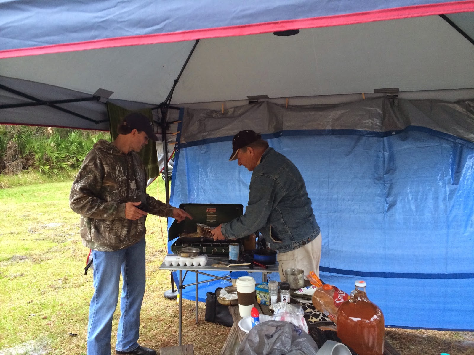
I awoke in the morning to Jeff and Cliff making breakfast. Cliff drove and towed his bike behind his car, so he had all kinds of food and camping equipment I am clearly a novice camper when in the company of these two!

It would appear that all my luggage exploded in my tent. This will take a while to repack.
 So, the funny thing about this whole trip so far is that I didn't realize that it was Daytona Bike Week and we were going there. We were only going to spend half a day and then head up to St. Augustine to meet more people and do more riding tomorrow. I had never been to Bike Week, so this should be interesting. Unfortunately, temps were in the mid to upper 50's and it was raining from the time we broke camp till the time we got done riding in the evening.

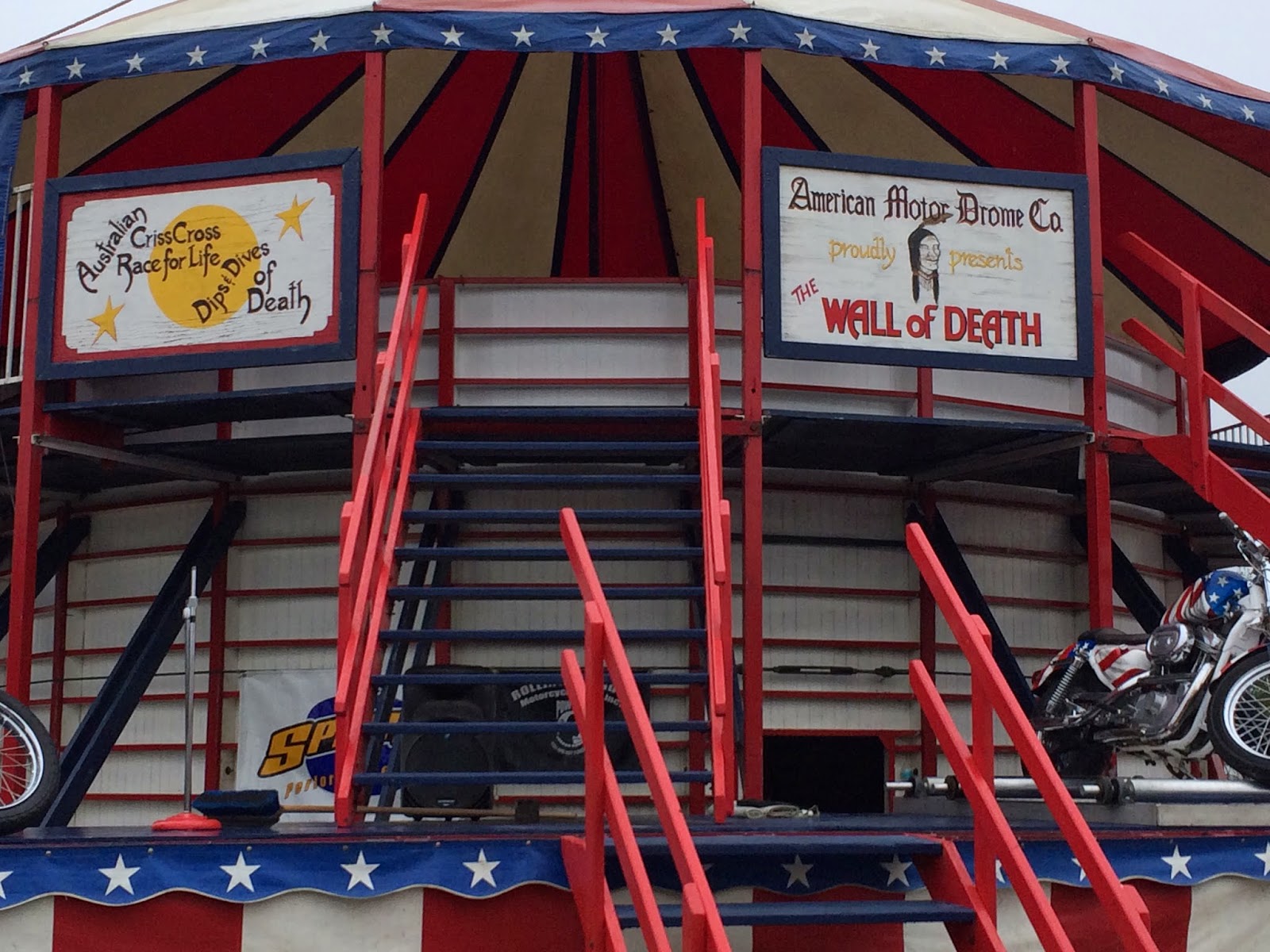


Our view for lunch...

Enough about the bug dancing around my screen. What I really need to write about is this trip. It was a last minute thing. I called up Jeff Kurtz and asked where he was. As it worked out, he was in Daytona, going to camp and start a ride around Florida tomorrow. I invited myself along, and here I am.
Getting to the camp site was challenging. There is a tiny little sign that indicates the way to the camp. Once there, finding Jeff and Cliff took awhile. It's a large campground. Jeff said to turn left after the registration area, go to the end and then turn right. I'd see his bike. I turned left went to the end and saw a gravel road. Jeff is an off road rider, so this wasn't a surprise. I took it. It went behind a bunch of buildings I kept going when I popped out the other side, went to the end of the park, hit another gravel road, took that and ended up back at registration, after traversing the whole park. After talking to the staff and consulting a map, I found the tent area; but, it is also huge. At this point, I was riding in the grass. Again, I got to the end of the road (grass), did a U-Turn and started heading back across the tent area on another "road." I saw Jeff's bike and my travels for the night was done! Jeff and Cliff greeted me. Cliff is an awesome, energetic guy and made me the best damn hot dogs I ever had. I don't know what he put on it. I suspect salt, ground pepper, garlic salt and who knows what else. They were fantastic.
Jeff had a tent pitched for me; but, by midnight, I was getting eaten alive by mosquitoes that were coming in through a top flap that doesn't shut well. I pitched my tent and it was incredibly easy since the moon was full and high in the sky. It was like pitching a tent during day light.
I awoke in the morning to Jeff and Cliff making breakfast. Cliff drove and towed his bike behind his car, so he had all kinds of food and camping equipment I am clearly a novice camper when in the company of these two!
It would appear that all my luggage exploded in my tent. This will take a while to repack.
So, the funny thing about this whole trip so far is that I didn't realize that it was Daytona Bike Week and we were going there. We were only going to spend half a day and then head up to St. Augustine to meet more people and do more riding tomorrow. I had never been to Bike Week, so this should be interesting. Unfortunately, temps were in the mid to upper 50's and it was raining from the time we broke camp till the time we got done riding in the evening.
You have the bigger generator. I concede.
Our view for lunch...
Subscribe to:
Posts (Atom)